
The Southern Ocean surrounding the Antarctic continent is a key region for the formation of the global climate.
Features of the ocean floor help determine how water masses move, ocean currents and how they affect the Earth’s climate. Biodiversity is also affected by landforms. For oceanographic and climate studies, it is necessary to have as accurate information as possible about the topography of the seabed. An international team of researchers recently presented the best and most detailed map for the Southern Ocean.
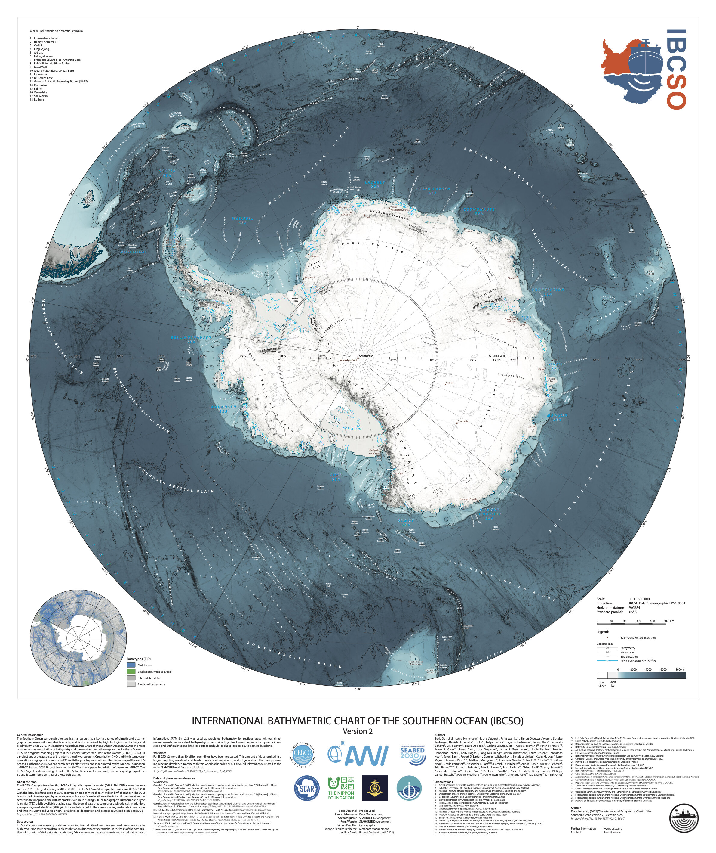
The International Bathymetric Chart of the Southern Ocean (IBCSO) is an international project coordinated by the AWI Polar and Marine Research Center, whose goal is to map the Southern Ocean. The first IBCSO digital bathymetric model (IBCSO v1) and a high-resolution map of the area south of 60°South latitude were released in 2013. Since then, the number of new measurement data has grown significantly.
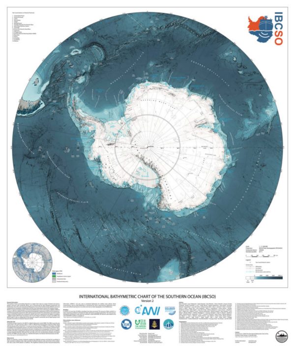
Photo in full resolution at the link.
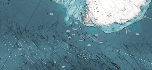
Since 2017, IBCSO has been part of the Nippon Foundation — GEBCO Seabed 2030 (General Bathymetric Chart of the Oceans) project. He has an ambitious goal — to explore all the world’s oceans by 2030. The new version of IBCSO — IBCSO v2 — for the Southern Ocean covers the entire territory south of the 50th parallel. The mapped seabed is 2.4 times larger than in the first version and at a high resolution of 500 by 500 meters. As a result, the Antarctic circumpolar Current and the key oceanographic “gates” necessary for its understanding — the Drake Strait and the Tasman Strait — have been fully explored. The map is based on more than 25.5 billion measurements provided by 88 institutions from 22 countries.
The Southern Ocean surrounding the Antarctic continent is a key region for the formation of the global climate. Here, the Antarctic circumpolar current is a key element in the thermohaline circulation covering the entire globe. It affects ocean currents in the Pacific, Atlantic and Indian Oceans. In addition, the cold water of the Southern Ocean absorbs a huge amount of CO? and heat from the atmosphere, creating a temporary buffer for many of the negative effects of anthropogenic climate change. In addition, these waters are characterized by high biological productivity and are home to a unique species diversity.